- IHM - Serices and knowledge transfer in the field of clutural and natural heritage

Rundlinge in Wendland: A Settlement Landscape
Project duration: 2012-2023
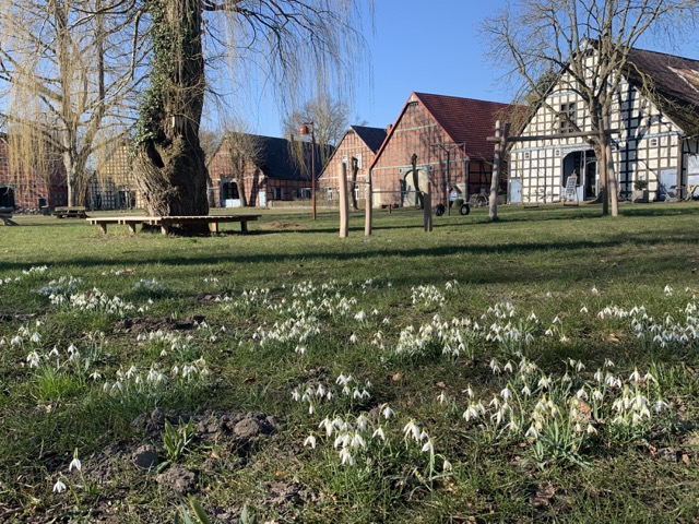
The “Rundlinge in Wendland: A Settlement Landscape” property represents a unique rural settlement landscape. Having been shaped over centuries, they represent a remarkable form of settlement with a high concentration and excellent state of preservation near the city of Lüchow. The villages were originally laid out in a horseshoe-like shape with a round, open village center and geographically located along the Elbe-Saale River line, a historically significant German-Slavic contact zone. The Rundlinge villages are characterized by their enclosed, round form and the hall houses grouped around the center, reflecting the development stages of the 18th and 19th centuries. Of the more than a thousand Rundling villages that once existed, only a few remain fully intact. However, numerous examples of these villages can still be found in a uniquely cohesive area in Wendland.
The settlement landscape is defined by systematically planned villages with wedge-shaped farm plots and radially aligned fields, often bordered by hedges and trees. The natural environment of the Rundling villages has significantly influenced their development, as they are mostly located on sandy soils and often surrounded by wet lowlands. With the 19 selected Rundlinge, Wendland had applied for inclusion on Germany's UNESCO Tentative List of this settlement landscape as a preserved village structure from the 12th century with vernacular architecture from the 18th and 19th centuries.
The IHM contributed to the application of the Rundlinge in Wendland: A Settlement Landscape for the German Tentative List. Other tasks included comprehensive consulting, handling public relations for the project, conducting an attribute mapping, developing a management plan, and carrying out heritage impact assessments.

